Saturday, October 31, 2020

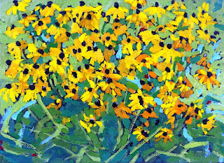
#2403 "Singleton Black Eyed Susans"


The name black-eyed Susan is an epithet of the flower's signature dark brown center. I had to look "epithet" up to discover that it was "an adjective or descriptive phrase expressing a quality characteristic of the person or thing mentioned". I should have known that. The legend says that the name black-eyed Susan originated from an Old English Poem written by John Gay entitled 'Sweet William's Farewell To Black-Eyed Susan'. Black Eyed Susan (Rudbeckia hirta) is a resilient wildflower that grows well in disturbed or unfavorable environments. The flowers blooms every other year but since it reseeds quickly, the black eyed susans seem to be blooming every year and everywhere. As a result the flowers are seen every year. Black eyed susans are heat and drought tolerant so should do well with climate change. I enjoy painting these happy looking flowers. 

The black eyed Susan flower (Rudbeckia hirta) belongs to the sunflower family and is the state flower of Maryland. It’s also a medicinal herb believed to treat colds, flu and even snakebites. Black Eyed Susans are indigenous to many sections of North America. They were introduced into Europe from North America soon after Columbus's visits and were named by Linnaeus in 1753. Linnaeus gave them the Latin name Rudbeckia Hirta after his mentor Olaf Rudbeck and hirta meaning rough, hairy. The plant was known and used by many Native American tribes. 

Oils on black oil tinted commercial canvas panel - 5 X 7 (inches) by a quarter inch in depth. Started 10:30 am Friday August 7th, 2020 standing on the large boulders just to the south of the Singleton home. It was a beautiful day with no biting insects.

I picked up a bit of a shed from a grey rat snake - my friend. It was very sunny and that was the only thing stopping me from going for a long paddle. 

For this and much more art, click on Pixels. Thank you.


Thursday, October 29, 2020

#2402 "Making Maritime Memories"


The story here is a man and a child who were presumably father and son out on a trip to Peggy's Cove in the pick-up truck. There was no indication of any female participating in this "Guy's Day Out" on a very foggy day. The thick advection fog was really thick and just offshore. 

I remember at the time not wanting to include any people in my paintings as I did not have the opportunity to ask permissions and they were not the intended subjects anyway. Decades later as I rekindle this memory, it is the unknown story behind the two guys who are the subject of this painting. The faces are not even clear in the supporting photographs. In the painting they are just included as a few very careful brush strokes. The little boy would be close to 45 years old today. I hoped it all worked out well but one will never know. 

This was when one could still go into the DeGarthe Studio and stand on the balcony at the rear. I vaguely recall that William was not there that day and I was not aware that he was really ill at the time. He had suffered a heart attack in 1979 and was diagnosed with cancer in 1982 about the time this picture was probably taken. He died in a Toronto hospital on February 13, 1983 - William E. deGarthe William deGarthe (1907–1983) . I once watched deGarthe at work on his granite sculpture. I did not take his picture while he was doing that out of respect for the artist. We spoke about art several times. Art is a way of life and a journey at the same time. The destination of the art and your life is never certain but one does their best along the way. 

For this and much more art, click on Pixels. Thank you.


Tuesday, October 27, 2020

#2401 "Hackett's Cove Fish Shacks"


Every fish shack seems to be somewhat unique. The structures are individuals like the fishermen who built them. They are architecturally designed to suit the peculiarities of that distinct portion of shoreline. Any large boulders are incorporated into the design. Those large boulders are called "leverites" for a good reason as they are simply too massive to move. The fishermen "leave them right there". The materials are certainly not extravagant and appear to be the most economical that will do the job. 

The fish shacks always seemed so quiet and peaceful to me. The fishermen must have been busy but I never really caught them in the act. The timetable of a tourist is far more relaxed than that of a working fisherman. I think of this painting as a tribute to their individualistic life style in the face of pressures coming from all directions including the weather. The home on the road at the top of the ridge detracted from the simpler Fish Shacks so I buried it in the trees. That is artistic licence. 

Capture of the Atlantic northwest cod stock
in million tonnes,
with Canadian capture in blue
The career of a fisherman is so tied to the elements and the ocean. I see fishing is a very precarious occupation. Government bureaucracies and foreign fishing factory boats are not helpful to the small fisherman who completes his occupation more in tune with the fish and the environment. The cod fishery was predictably driven into extinction and it was not at the hand of the small costal fisherman. The Northern Cod biomass fell to 1% of earlier levels as noted in the summer of 1992. The cod fishery simply collapsed. There were no Wall Street Lawyers representing Joe Codfish. A moratorium on the Northern Cod fishery was at first meant to last two years. I believe the moratorium still continues in one fashion or another as I paint this tribute to Hackett's Cove and a way of life. 

Apparently the major factor that contributed to the depletion of the cod stocks off the shores of Newfoundland was the introduction of equipment and technology that increased the volume of landed fish. From the 1950s onwards, new technology allowed fishermen to trawl a larger area, fish deeper, and for a longer time. By the 1960s, powerful trawlers equipped with radar, electronic navigation systems, and sonar allowed crews to pursue fish with unparalleled success. The Canadian catches peaked in the late1970s. Cod stocks were depleted at a faster rate than could be replenished. Trawlers caught enormous amounts of non-commercial fish as well. These other fish were economically unimportant but very important ecologically. This incidental catch undermined the ecosystem stability, depleting stocks of important predator and prey species. 

Approximately 35,000 fishermen and fish plant workers lost their jobs due to the collapse of the cod fisheries, with devastating impact on the Newfoundland and other maritime communities. The collapse of the northern cod fishery marked a profound change in the ecological, economic and socio-cultural structure of Atlantic Canada. The moratorium in 1992 was the largest industrial closure in Canadian history. 

"Four Fish" by Paul Greenberg
The exploitation of the riches of the globe seems to know no bounds. Simple greed. "Four Fish", a book by Paul Greenberg details the sad story of exploitation and the decline of the worlds fishery. Nature needs representation at the bargaining table when the movers and shakers are diving up the shares and exploiting the riches of the environment. I figure if I am going to have an opinion, I wll do my very best to make it an informed one. I read a non-fiction to discover the facts so I can separate out the fiction from the lobbyists. 

Oils on burnt sienna oil tinted commercial stretched canvas - 14 X 18 (inches) by 3/4 (0.750) inches in depth. The timing of this image would have been the spring of 1985 - before we moved back to Upper Canada in the summer of that year. 

For this and much more art, click on Pixels. Thank you.


Sunday, October 25, 2020

#2400 "Hackett's Cove Memories"

#2400 "Hackett's Cove Memories"

We arrived in Nova Scotia 1977 as my first posting with the Atmospheric Environment Service was Canadian Forces Base Shearwater, CYAW. Nova Scotia was a great place to learn about the weather and meteorology. Fog was the great humbler that always arrived just when you thought you might be starting to learn something. We frequently travelled Route 333 with visitors and spent the day exploring the coves and craft shops. The day trip also took us to many painting places along the South Shore. We made a great many new friends along Route 333. 


Hackett's Cove is one of the many small ports along the South Shore's Route 333. Hackett's Cove is situated southwest of Glen Margaret and south of Woodens River. 

A Google search describes it as "Hackett's Cove is a rural community of the Halifax Regional Municipality in the Canadian province of Nova Scotia on the Chebucto Peninsula. The community is home to radio transmitter maker Nautel Ltd." That Internet description does not do the community justice. There was a lot of painting material at Hackett's. The paintings of Hackett's Cove in this series do not even scratch the beautiful surface. 

The timing of this image would have been the spring of 1985 just before we moved back to Upper Canada in the summer of that year. I had a career change to become an Instructor in the Training Branch of the Atmospheric Environment Service. My research in satellite and remote sensing applications was catching on. 

Oils on burnt sienna oil tinted commercial stretched canvas - 14 X 18 (inches) by 3/4 (0.750) inches in depth. Started 11:00 am Sunday August 2nd, 2020.

For this and much more art, click on Pixels. Thank you.


Friday, October 23, 2020

#2399 "Peggy's Cove Memories"


I was behind the camera on this Maritime memory. We frequently had company visiting us in Nova Scotia when I was first posted to Canadian Forces Base Shearwater, CYAW with the Atmospheric Environment Service. Peggy's Cove was and is always a great place to go. I have painted these boats many times before. The red boat had a white super structure in 1985 instead of turquoise as I had painted it earlier in 1979. There is a lot of history in this tiny cove. 

Peggy's Cove, Nova Scotia
According to legend, Peggy's Cove was named after the only survivor of a schooner that ran aground on Halibut Rock and sank in the mid 1800's. The woman was named Margaret. My acquaintance artist and cove resident William deGarthe said that the survivor was a young woman while others claim she was a little girl too young to remember her name and the family who adopted her called her Peggy. The young shipwreck survivor married a resident of the cove and became known as "Peggy of the Cove". Visitors from around the bay eventually named the village Peggy's Cove, after her nickname. 

Another version of the story behind the name goes back much further though and more than a hundred years before Canada. Apparently the first recorded name of the cove in 1766 was Eastern Point Harbour or Peggs Harbour. The village is likely named after Saint Margaret's Bay and Peggy is the preferred nickname for Margaret. Samuel de Champlain had named the large bay after his mother Marguerite Le Roy. 

The village was founded in 1811 when the Province of Nova Scotia issued a land grant of more than 800 acres to six families of German descent. The settlers relied on fishing as the mainstay of their economy but also farmed where the soil was fertile. They used the surrounding lands to pasture cattle. In the early 1900s the population peaked at about 300. The community supported a schoolhouse, church, general store, lobster cannery and boats of all sizes that were nestled in the cove. As roads improved, the number of tourists increased. Today the population is smaller but Peggy's Cove remains an active fishing village and a favourite tourist destination. 

The original lighthouse was built in 1868. Exactly 100 years later, in 1968 the Campbell family opened the Sou'Wester Restaurant. 

We arrived in Nova Scotia 1977 as I started my career as a meteorologist. Nuclear physics was fun but Three Mile Island had cast a pall over nuclear energy. I had always been excited by the environment and hoped I could make a difference in the science. Nova Scotia was a terrific place to learn about the weather and meteorology. We frequently travelled Route 333 to the Sou'Wester Restaurant especially when the weather was forecast to be really nasty. We could bring some business to the quiet dining room and watch the surf break up to the lighthouse. Everyone had a good day and I would often find painting material. 

Looking northeast across Peggy's Cove 1985
We loved touring the beautiful province and it was a challenge to leave the Maritimes to follow my career. It was important to learn about the other weather regimes of Canada and that required some moving around. It was also important to paint something other than Peggy's Cove. 

This was a commission for my wife and I selected the finest canvas that I had to paint on. It brings back a lot of very fine memories. 

For this and much more art, click on Pixels. Thank you.


Wednesday, October 21, 2020

#2398 "Searching for Franklin"


This is the treed shore of Franklin Island in the Parry Sound Archipelago. The forest was thick right down to the edge of the water. It would be challenging to find anyone in that forest even though it was on an island. It was hard to find the island for the trees...

The name of the island and the date made me think of two famous, missing people and that helps to explain the cryptic name of the painting. I first considered this painting on July 16th which was the date when Tom Thomson's body was discovered. I had chores to do so it took me another couple of days to actually start to paint. It was July 18th when I finally got to paint. 

It was a very hot and humid day. The bugs were not bad though. I retreated into the studio. The location of this scene is very near N45.382501 W80.341335. 

This is another Ro-Lak-Tree (a name I made up) Painting. It is a nature stewardship game that the Group of Seven invented while they were searching for the Canadian identity around the time of the 1918 Flu Pandemic. I am repeating that adventure of painting Canadian rocks, lakes and trees during COVID 2019. 

For this and much more art, click on Pixels. Thank you.


Monday, October 19, 2020

#2397 "Talon Falls Rock Face"


My son and I and a group of new friends were paddling down the Mattawa like Big Joe Mufferaw in mid June 2016. There was a lot of painting material to be discovered around every bend in the historic Mattawa, the "junction of waterways" or the "river with walls that echo its current". We took the southern route and had the time of our lives! There was enough water to run all of the rapids except of course for the major falls. 

We were just about to head down the Mattawa after our portage of Talon Falls. This rock just downstream from Talon Falls had a lot of character and it caught my eye. I included the tip of one of our yellow canoes at the end of the portage. I decided against including more canoes as it distracted from the simpler composition and the geology of the rock face. I used a very smooth and slippery surface and had a lot of fun with even more oil paint. 

There was a lot of beautiful subject matter along the Mattawa River although most of it required the vantage point of the canoe. 

For this and much more art, click on Pixels. Thank you.


Saturday, October 17, 2020

#2396 "The Mattawa Downstream from Talon Falls"


 I painted this on July 8th, the anniversary of Tom Thomson's death. 

Actually he probably died late in the evening on this date and his body hit the waters of Canoe Lake at 12:15 am on Monday July 9th. 1017. That is a long story and no one really knows anyway. Tom's watch stopped at about that time but everyone thought it was early on Sunday afternoon and his watch was just a half hour slow. I have always been much more interested in his art and life rather than the mystery of his death. I have presented "Tom Thomson Was a Weatherman" many, many times starting in the mid 1980's. Tom was passionate about the weather and the nature of Canada. For me, weather also provided a long and interesting career. 

Tom's other passion was fishing. His artist firend, J.E.H MacDonald took this photo of Tom fiddling with a silver trout spoon in 1915-1916. You could criticize Tom's art but he did not take kindly to anyone finding flaws in his fishing. 

The canoes were lined up ready to head down the Mattawa after completing the Talon Portage. I had climbed the cliff to achieve this interesting vantage. Finding new Canadian subject matter for me has been typically as simple as just turning around and looking in the other direction. This was the case all up and down the Mattawa. The Mattawa River name is derived from the Algonkian, Mattawa which means "junction of waterways" or "river with walls that echo its current". This section of the river explains the second possible meaning. In the exploration and fur trade era of 1610 to the 1800's, its nine rapids and two falls were portaged by voyageurs carrying birch bark freight canoes. It was perhaps the most demanding waterway between Lachine and Fort William (Thunder Bay). Today, Mattawa River and Samuel de Champlain Provincial Parks protect the river. For its outstanding historical natural and recreational value, the Mattawa was designated a Canadian Heritage River in January 1988. 

For this and much more art, click on Pixels. Thank you.


Thursday, October 15, 2020

#2395 "Downstream from Talon Falls"


My son and I and a group of new friends were paddling down the Mattawa like Big Joe Mufferaw in mid June 2016. There was a lot of painting material to be discovered around every bend in the historic Mattawa, the "junction of waterways" or the "river with walls that echo its current". We took the southern route and had the time of our lives! There was enough water to run all of the rapids except of course for the major falls. 

After taking the Talon Portage, we paddled up to take a closer look at the impressive Talon Falls. On the way back the expedition leader Bob took a nap while his wife Silvia managed the canoe. That is one of the benefits of being the paddler in the stern. I used a lot of oil with fairly large brushes on this small and very rough panel. Shakespeare once said that it was “A poor thing, but my own”. He meant that something unique crafted with your own touch is worth more than any rich thing that belongs to someone else. There is some personality in these bold tiny portraits even though you cannot really see the faces. 

The Mattawa River provides a natural connection between the Ottawa River and Lake Nipissing, following a 600 million year-old geological fault line through the Canadian Shield, visible at Paresseux Falls. 

Over 10,000 years ago, after the melting of the ice sheets that used to cover Ontario, the Great Lakes emptied into the Ottawa River via the Mattawa River instead of via Lake Ontario and the St. Lawrence River. Canada's first known, and Ontario's only major, deposit of brucite marble, a colouring agent used in paper production, is located on this river near Talon Chute. 

I had returned to painting some wonderful memories since COVID-19 required self-isolation. I was using the rough side of an historic piece of masonite. An artist friend had passed away and his spouse offerred me his remaining panels to use. I promised to use them all in his memory. 

For this and much more art, click on Pixels. Thank you.


Monday, October 12, 2020

#2420 "In the Shade of the Sunflower"


The morning was open for painting. I decided to keep the sun on my back and paint looking up into the head of the giant sunflower plant. The colours were different. 

The sunflower came from Wendy Banks, a proud, 6th generation farmer from Lyndhurst. Wendy's Country Market can be found at ​408 Fortune Line Road in the Rideau Lakes Township. To quote Wendy and to summarize how I feel, we are " In the middle of nowhere, and the centre of everything!" Wendy mailed out small packets of sunflower seeds in the COVID spring of 2020. We planted the three seeds. Chipmunks got two of them but the survivor turned into a giant almost worthy of Jack and the Bean Stalk. A tape measure had it at ten feet tall and it still grew a few inches. I put a support tie on it to prevent it from being blown over by the Singleton winds. 


The red shouldered hawk scolded me again while I painted. It paused directly overhead and took a good and close look at me. Hickory nuts were falling naturally as well as being launched from the upper limbs by squirrels. Life is never dull en plein air. 

Normally sunflowers will bloom anytime between mid-July and mid-August. It all depends on the sun, rain, warm temperatures and cold temperatures. The blooms look amazing for about two weeks and then start to fade. As the plant matures and starts making the seeds, the yellow flower starts to droop and die off. This is the natural progression for a sunflower. 

Vincent would have loved to paint those flowers. I know I did. I plan to do a series at different stages of growth and even decay. Life is good.  

For this and much more art, click on Pixels. Thank you.


Sunday, October 11, 2020

#2394 "Talon Chute"


Talon Chute is a waterfall on the Mattawa River and one of five important portages. It is located at the south-eastern end of Lake Talon about 2 kilometres east of the community of Blanchard's Landing. The Chute is accessible only from the water or on foot. It features a water control dam and was once the site of a brucite marble mine. 

My son and I paddled up to have a closer look at the tremendous amount of water that tumbled through the narrow channel. That is why we portaged the dam. 

I had returned to painting some wonderful memories since COVID-19 required self-isolation. I was using the rough side of an historic piece of masonite. An artist friend had passed away and his spouse offerred me his remaining panels to use. I promised to use them all in his memory. This was a studio work because the summer sun and heat were oppressive. 

For this and much more art, click on Pixels. Thank you.


Thursday, October 8, 2020

#2393 "A Mattawa Portage"


This is Paresseau Falls downstream from Portage de Talon on the Mattawa River in June 2016. My son and I paddled up from the end of the portage to take a closer look. This was the very good reason behind the portage. This was the last of a series of portages headed up the Mattawa River. The Voyageurs travelling upstream no longer needed their river poles. The canoeists would throw away their river poles or "perches" at the Portage des Perches which bypassed Paresseau Falls. Those push poles had all rotted away by the time we made the portage around the falls. 


I had returned to painting some wonderful memories since COVID-19 required self-isolation. I was using the rough side of an historic piece of masonite. An artist friend had passed away and his spouse offerred me his remaining panels to use. I promised to use them all in his memory. This was a studio work because the summer sun and heat were oppressive. The air conditioning was not working in the Singleton Studio so it was starting to get warm in there as well. 

For this and much more art, click on Pixels. Thank you.


Tuesday, October 6, 2020

#2392 "Piney Rock"


Rumble Island supported some beautiful pines. This copse of trees has survived in very little soil. The last ice age had exported most of our soil to south of the Great Lakes. Each of these trees might have been an individual character but together they were a choir played by the wind. 


Alone on this hunk of rock, all one can hear is the whisper of the wind through the pine needles. The trees on the rocky islands of the Parry Sound Archipelago are not protected from the winds or the weather. The trees take the survival approach of bending with the wind. Why fight it? Nature will always win in the long run and that is as it should be. We need to be better stewards of the land. 

I used a lot of oil on this smooth and slippery surface. 

For this and much more art, click on Pixels. Thank you.


Sunday, October 4, 2020

#2391 "Pines Rock Water 2020"


Rumble island is very rugged. It is another of the 30,000 islands that comprise the Parry Sound Archipelago . One would have to look hard for a safe place to land a canoe. The trees were reaching toward the east with their blown over backs facing the west. Even enduring the constant pressure of the weather, these trees were doing the breathing for the planet like other trees all around the world. They seemed happy in their work. 

My wife thinks I should paint more structures. My portfolio is perhaps full of too many rocks, lakes and trees. There are not many structures unless I leave the Singleton Sanctuary and that is not in the COVID cards. 

Rocks, lakes and trees reminded me of the rock, paper and scissors game. That hand game is also known by other permutations such as scissors paper rock, scissors paper stone or even ro-sham-bo. Two people simultaneously form one of three shapes with an outstretched hand. These shapes are "rock" (a closed fist), "paper" (a flat hand), and "scissors" (a fist with the index finger and middle finger extended, forming a V). "Scissors" is identical to the two-fingered V sign (also indicating "victory" or "peace") except that it is pointed horizontally instead of being held upright in the air. Ro-sham-bo is a simultaneous, zero-sum game that has only two possible outcomes: a draw or a win for one player. 

On the other hand, rocks, lakes and trees is a slight of hand game played with a brush loaded with oil paint. Everybody wins as long as nature is appreciated and protected. Ro-Lak-Tree (a name I made up) is a nature stewardship game that the Group of Seven invented while they were searching for the Canadian identity around the time of the 1918 Flu Pandemic. 

Tom Thomson (back left) with his city visitors (left to right) F.H. Varley, A.Y. Jackson, and Arthur, Marjorie, and Esther Lismer in Algonquin Park, fall 1914. Photograph likely taken by Maud Varley. 

The portfolios of Tom Thomson and his friends who would create the Group of Seven were loaded with rocks, lakes and trees. This COVID-2019 version is my attempt to continue to record the character of Canada in oils. I promise to include more structures in that identity but do not expect the city scapes of glass and steel. 

Alberta Pandemic Poster 1918

The 1918 flu pandemic or the Spanish flu was an unusually deadly influenza pandemic caused by the H1N1 influenza A virus. The 1918 pandemic infected 500 million people which was a third of the world's population at the time. It struck in four successive waves between February 1918 and April 1920 - more than two years. The death toll is typically estimated to have been somewhere between 17 million and 50 million, making it one of the deadliest pandemics in human history. 

Sadly history repeats itself. It is time to respect nature and to heal the scars that man-kind has inflicted on the planet. 

For this and much more art, click on Pixels. Thank you for playing rocks, lakes and trees better known as Ro-Lak-Tree.


#2908 "December Sunrise Cold Fropa"

#2908 "December Sunrise Cold Fropa" 11x14 inches 8 am on Tuesday, December 17th, 2024  from very near N44.522754 W76.105050 The De...