 |
| #2587 "Saturday Singleton Sunset" |
The cold front had passed through and the skies were clearing for just a short while. Gusty northwesterly winds were rolling the turbulent stratocumulus around.
 |
| Radar with cold front to the east of Singleton which is almost in the center of the image |
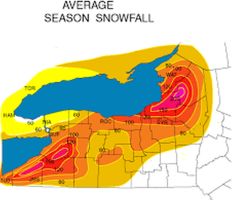
There was some residual cold frontal moisture overhead. Some clouds far to the southwest were the start of circulation snowsqualls off Georgian Bay. The snowsqualls developed off Lake Ontario to our south immediately behind the cold front. The Tug Hills east of Lake Ontario get a snootful (that is a lot) of snow in these weather situation! There is a reason that we live at Singleton. We miss almost all of the lake effect snowsqualls. Only a squall from 230 degrees off Lake Ontario could possibly reach Singleton and the air originating from the southwest is rarely cold enough to generate significant flurries.
For this and much more art, click on Pixels. Thank you.


No comments:
Post a Comment